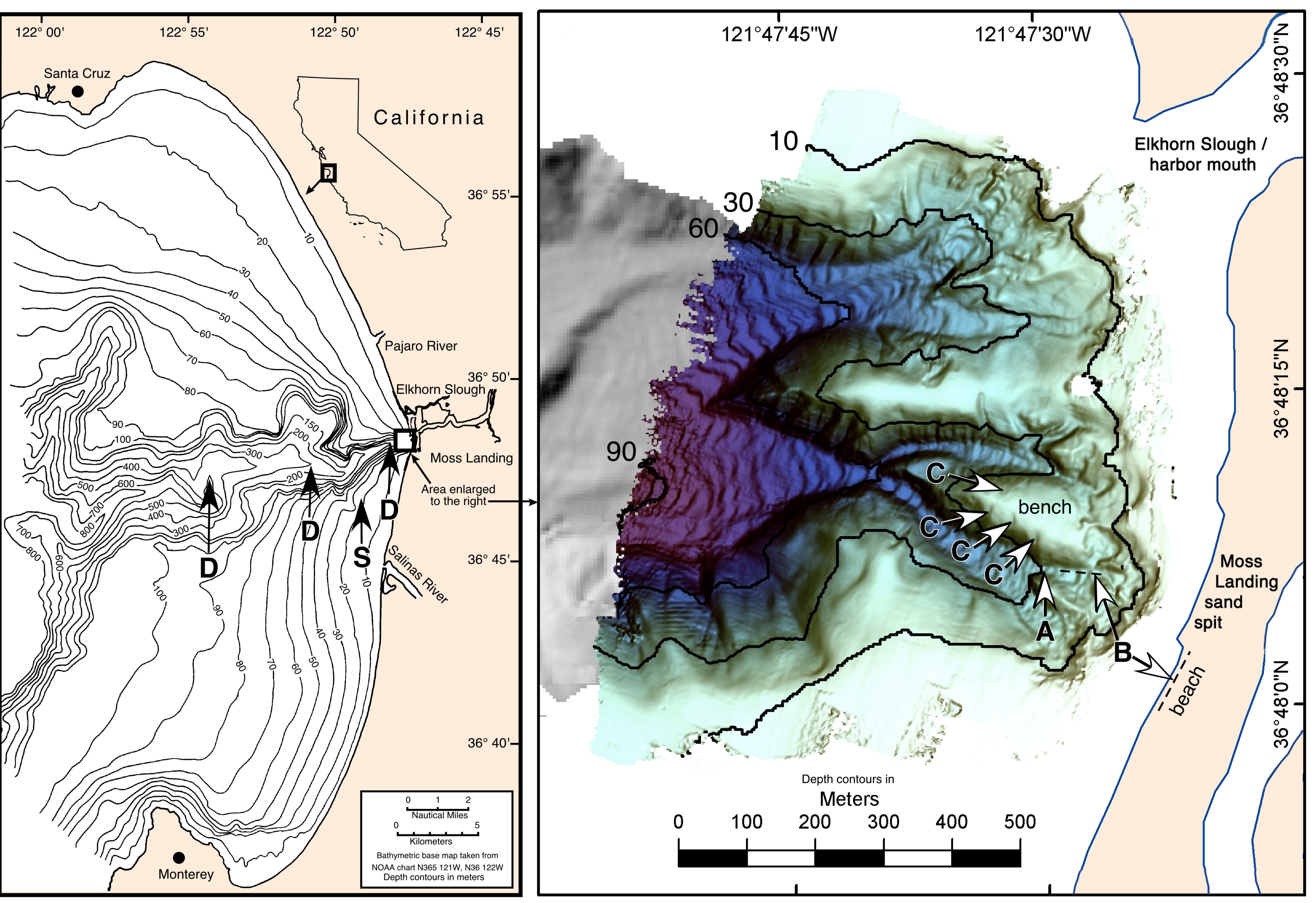
Figure 1. Study area and locations of sampling and experimentation: (A) 30m axis station; (B) drift algae survey areas; (C) hanging channels; (D) deep sampling stations; (S) sandflat station. Canyon head map
is a shaded relief digital elevation model of 1999 multibeam bathymetry sonar data (Seafloor Mapping Lab, CSUMB). From Macrobenthic Colonist Guilds and Renegades in Monterey Canyon Drift Algae: Partitioning Multidimensions., T.A. Okey.