


DATA LIBRARY
NORTH CENTRAL CALIFORNIA MAPPING PROJECT DATA
Data presented here include a series of remotely sensed images (multibeam, side scan sonar), derived data (bathymetric contours, grid analyses, etc.), habitat analyses, associated data sets (survey footprints, coastline), and FGDC metadata, grouped by survey location. To download zipped data files from the tables, click on the Data Type name under the desired survey location. Data are presented in ESRI ArcGIS format (shapefiles, grids). Multibeam and sidescan images are Geotiffs. These data are NOT to be used for navigational purposes.
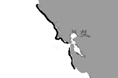
For general data searches, use the SURVEY LOCATION LIST or MAP LOCATOR
Please review our Data Use Policy
Data
Format |
File
Size MB (zipped) |
Data
Footprint Preview |
|
| Phase I: Stinson Beach to Año Nuevo (CC 00-11) | |||
| Phase I: Block CC_00 (Stinson Beach) |
 |
 |
 |
GeoTiff |
60 |
||
GeoTiff |
42 |
||
GRID |
45 |
||
Shapefile-pts, lines, polygons |
3 |
||
| GRID | 18
|
||
TXT |
63 |
||
.sd, Iview3D viewer |
133 |
||
| Shapefile-lines | 219 |
||
| GRID, TXT, Fledermaus | 63 |
||
| Phase I: Block CC_01 |
|
|
|
GeoTiff |
2 |
||
GeoTiff |
5 |
||
GRID |
4 |
||
Shapefile-pts ,lines, polygons |
<1 |
||
| GRID | 12
|
||
TXT |
7 |
||
.sd, Iview3D viewer |
11 |
||
| Shapefile-lines | 11 |
||
| Phase I: Block CC_02 |
|
|
 |
GeoTiff |
40 |
||
GeoTiff |
60 |
||
GRID |
30 |
||
Shapefile-pts, lines, polygons |
2 |
||
| GRID | 11
|
||
TXT |
45 |
||
.sd, Iview3D viewer |
65 |
||
| Shapefile-lines | 81 |
||
| Phase I: Block CC_03/04 |
|
|
 |
GeoTiff |
70 |
||
GeoTiff |
101 |
||
GRID |
52 |
||
Shapefile-pts, lines, polygons |
3 |
||
| GRID | 19
|
||
TXT |
73 |
||
.sd, Iview3D viewer |
102 |
||
| Shapefile-lines | 112 |
||
| Phase I: Block CC_05 |
|
|
 |
GeoTiff |
67 |
||
GeoTiff |
85 |
||
GRID |
57 |
||
Shapefile-pts, lines, polygons |
3 |
||
| GRID | 29
|
||
TXT |
63 |
||
.sd, Iview3D viewer |
131 |
||
| Shapefile-lines | 80 |
||
| Phase I: Block CC_06 |
|
|
 |
GeoTiff |
92 |
||
GeoTiff |
109 |
||
GRID |
78 |
||
Shapefile-pts, lines, polygons |
3 |
||
| GRID | 40
|
||
TXT |
77 |
||
.sd, Iview3D viewer |
176 |
||
| Shapefile-lines | 150 |
||
| Phase I: Block CC_07 |
|
|
 |
GeoTiff |
87 |
||
GeoTiff |
105 |
||
GRID |
71 |
||
Shapefile-pts, lines, polygons |
4 |
||
| GRID | 34
|
||
TXT |
76 |
||
.sd, Iview3D viewer |
172 |
||
| Shapefile-lines | 144 |
||
| Phase I: Block CC_08 |
|
|
 |
GeoTiff |
62 |
||
GeoTiff |
80 |
||
GRID |
55 |
||
Shapefile-pts, lines, polygons |
3 |
||
| GRID | 24
|
||
TXT |
60 |
||
.sd, Iview3D viewer |
96 |
||
| Shapefile-lines | 150 |
||
| Phase I: Block CC_09 |
|
|
 |
GeoTiff |
92 |
||
GeoTiff |
115 |
||
GRID |
79 |
||
Shapefile-pts, lines, polygons |
3 |
||
| GRID | 34
|
||
TXT |
82 |
||
.sd, Iview3D viewer |
101 |
||
| Shapefile-lines | 184 |
||
| Phase I: Block CC_10 |
|
|
 |
GeoTiff |
78 |
||
GeoTiff |
94 |
||
GRID |
67 |
||
Shapefile-pts, lines, polygons |
3 |
||
| GRID | 28
|
||
TXT |
71 |
||
.sd, Iview3D viewer |
108 |
||
| Shapefile-lines | 217 |
||
| Phase I: Block CC_11 |
|
|
 |
GeoTiff |
88 |
||
GeoTiff |
100 |
||
GRID |
74 |
||
Shapefile-pts, lines, polygons |
3 |
||
| GRID | 37
|
||
TXT |
73 |
||
.sd, Iview3D viewer |
113 |
||
| Shapefile-lines | 149 |
||
| Phase II: Bodega Bay to Bolinas (A01-A11) | |||
| Phase II: Point Arena to Bodega Bay (B01-B14) | |||