|
|
|
|
|
|
|
Participant Presentations |
|||||
| Workshop Introduction- Goals, Objective, Process | Kvitek, CSUMB Seafloor Mapping Lab | ||||
| Update and Overview of Seafloor Mapping Techniques, Capabilities, Interpretation & Applications | Kvitek, CSUMB Seafloor Mapping Lab | (zip with videos 106MB) |
|||
| Habitat and Other Derivative Maps- Added Value to Seafloor Images and Maps | Greene, MLML Center for Habitat Studies | ||||
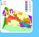
| Geologic Mapping by the California Geological Survey along the California Coast | Wills, California Geological Survey | ||||
Data Acquisition & Processing Considerations |
Lockhart, Fugro Pelagos | ||||
| Recent & Future Seafloor Mapping Plans of the USGS Coastal & Marine Geology Team | Cochrane, USGS Coastal & Marine Geology | ||||
Baseline Monitoring of the Channel Islands MPAs |
Rosen, Marine Applied Research & Exploration | (zip with videos 111MB) |
|||
| California Derelict Fishing Gear Removal Pilot Project | Gilardi, SeaDoc Society/ UC Davis | ||||
Mapping Maineland Shelf Benthic Habitats Offshore of San Pedro, California |
Edwards, USGS Coastal & Marine Geology | ||||
| MBARI AUV Mapping Program | Caress, Monterey Bay Aquarium Research Institute | ||||
Seafloor Mapping Technology (Subbottom Profiles) |
Driscoll, Scripps Institute of Oceanography | ||||
Regional Data Holdings & Needs within California State Waters |
Kvitek, CSUMB Seafloor Mapping Lab | ||||