Merged Kelpfly (color) & conventional sonar (grayscale) data
provide comprehensive coverage
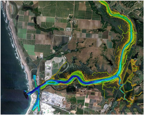
Merged Kelpfly sonar and topographic LiDAR coverage of Elkhorn Slough National Estuarine Research Reserve - colored by depth

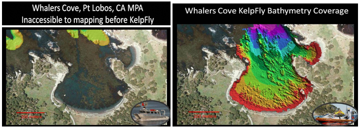
Heavy kelp canyon and rocky shoal area (left) successfully mapped with Kelpfly - results (at right) clearly delineate rocky habitat features and sand channels up to the shoreline (colored by depth at 2m contours)

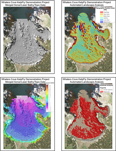
Semi-automated landscape visualization and classification analysis performed on the DEMs created from the merged sonar and vessel-based topographic LiDAR data at Whalers Cove, Carmel, CA.
|