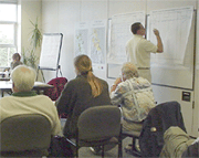
IDENTIFICATION OF PRIORITY HABITAT MAPPING LOCATIONS: NORTHERN, CENTRAL, AND SOUTHERN REGIONAL GROUPS
OBJECTIVE - Review and discuss marine habitat information needs and holdings for each region.
The three working sessions began with each facilitator reviewing wall-size tables and maps summarizing the pre-workshop surveys and proposing guidelines & criteria for additional site selection based on the second workshop notice information. Participants divided into subset groups, by agency, to review Worksheet A and maps and identify the highest priority cells (blocks) that were not already determined in the pre-workshop survey. Participants were instructed to provide information on mapping needs and, if available, any information on existing or planned data holdings related to those identified blocks. Based on priority block identification for each separate region, participants were instructed to determine block priorities based on specific economic and environmental habitat parameters/ criteria (e.g. fishery management, parallel use conflicts, zoogeographical importance, etc) for all regions and blocks.


DATA SHARING PROTOCOL
OBJECTIVE - Considerations for establishing and maintaining data sharing among various resource agencies.Working group facilitated by Mary Tsui, Land Systems Group and Tim Goodspeed, NOAA, Special Projects Division.
Following a morning presentation on the issues surrounding data documentation and data sharing, a breakout session was held to answer specific questions and concerns and to determine whether or not an agreement could be crafted and presented to the full conference. The roundtable discussion on data sharing among resource agencies presented the following concerns: where were existing data stored, what would be the format for disseminating and repository for newly collected data, multiple platforms and data formats to accommodate a variety of users, overhead cost associated with formatting those data, classification of terms used in existing numerous (i.e. field titles and data terms vary from user to user). As with multiple platforms, there is considerable overhead with making data usable to other researchers. Finally, some attendees were very concerned with the possible premature release of data and QAQC.
DEVELOPMENT OF HABITAT CLASSIFICATION SCHEME
OBJECTIVE - Discussion on the adoption of a universal marine habitat classification scheme. Working group facilitated by Gary Greene, Moss Landing Marine Labs and Tom Culliton, , NOAA, Special Projects Division.
A standard, universally useful habitat classification scheme needs to be agreed to if descriptions of habitats are to be accurately and efficiently applied among scientific disciplines. In recent years, many marine benthic habitats have been described using geophysical and biological data. These descriptions can vary from one investigator to another, which make it difficult to compare habitats and associated biological assemblages among geographic regions. Using marine geophysical data collected with a variety of remote sensor systems and in situ biological observations for habitat assessment of deepwater rockfishes, Greene et al. (1999) constructed a classification scheme that can be used in describing marine benthic habitats. It was suggested that the scheme first be adapted to CDF&G and OSPR needs, and then be used to reinterpret the marine geology maps of the entire California continental shelf, compiled and published (1986) by Dr. Gary Greene of the USGS and Mike Kennedy of the California Department of Conservation Mines and Geology division (CDM&G), and digitized by the CSUMB group. Each of these substrate maps has a companion metadata map of equal size and scale defining and cataloguing the type, resolution, quality and source for all of the original data used in the compilation, to produce a new set of attributed GIS vector themes for essential marine habitats.
