


DATA LIBRARY
CENTRAL CALIFORNIA DATA
Data presented here include a series of remotely sensed images (multibeam, side scan sonar), derived data (bathymetric contours, grid analyses, etc.), habitat analyses, associated data sets (survey footprints, coastline), and FGDC metadata, grouped by survey location. To download zipped data files from the tables, click on the Data Type name under the desired survey location. Data are presented in ESRI ArcGIS format (shapefiles, grids). Multibeam and sidescan images are Geotiffs. These data are NOT to be used for navigational purposes.
For general data searches, use the SURVEY LOCATION LIST or MAP LOCATOR
Please review our Data Use Policy
Data
Format |
File
Size MB (zipped) |
Data
Footprint Preview |
|
| CA Geology Series- Continental Margin | 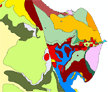 |
||
Shapefile,
polygon |
47 |
||
| ArcGIS(8.3), mxd | 47 |
||
 |
 |
 |
|
GeoTiff |
29 |
||
GeoTiff |
59 |
||
Shapefile, polygon |
11 |
||
TXT |
1.7G |
||
.sd, Iview3D viewer |
1.3G |
||
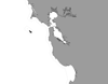
San Francisco Bay (mouth)- Entrance Channel (2004) |
|||
GeoTiff |
11 |
||
GeoTiff |
25 |
||
GeoTiff |
49 |
||
GeoTiff |
110 |
||
GRID |
21 |
||
TXT |
63 |
||
TXT |
63 |
||
.sd, Iview3D viewer |
107 |
||
San Francisco Bay (mouth)- North |
|||
GeoTiff |
11 |
||
GeoTiff |
25 |
||
GeoTiff |
49 |
||
GeoTiff |
110 |
||
GeoTiff |
138 |
||
GeoTiff |
167 |
||
GeoTiff |
77 |
||
GRID |
106 |
||
San Francisco Bay (mouth)- South |
|||
GeoTiff |
8 |
||
GeoTiff |
18 |
||
GeoTiff |
34 |
||
GeoTiff |
|||
GeoTiff |
7 |
||
GeoTiff |
15 |
||
GeoTiff |
33 |
||
GeoTiff |
70 |
||
GeoTiff |
170 |
||
GeoTiff |
234 |
||
GeoTiff |
90 |
||
GRID |
128 |
||
| West Bay (2008), San Francisco Bay |
 |
||
GeoTiff |
12 |
||
GeoTiff |
30 |
||
GeoTiff |
43 |
||
GeoTiff |
164 |
||
GRID |
84 |
||
GRID |
24 |
||
TXT |
247 |
||
TXT |
63 |
||
.sd, Iview3D viewer |
112 |
||
Shapefile, point |
26 |
||
| West Bay 2014 (vicinity of Angel Island) |
|||
GeoTiff |
35 |
||
GRID |
74 |
||
TXT |
44 |
||
.sd, iview4D viewer |
48 |
||
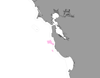
| San Francisco Bay Shallow Water Backscatter and Bathymetry Mapping-2014 |
|
 |
|
| Presidio Shoals, San Francisco Bay |
|
|
|
GeoTiff |
3 |
||
GeoTiff |
6 |
||
GeoTiff |
45 |
||
GRID |
17 |
||
Shapefile,
line |
<1 |
||
Shapefile, polygon |
<1 |
||
Shapefile, point |
<1 |
||
TXT |
17 |
||
.sd, Iview3D viewer |
24 |
||
| San Pablo Bay |
|
 |
 |
GeoTiff |
14 |
||
GeoTiff |
33 |
||
GeoTiff |
374 |
||
GRID |
27 |
||
Shapefile, polygon |
<1 |
||
Shapefile, point |
<1 |
||
TXT |
22 |
||
.sd, Iview3D viewer |
96 |
||
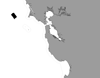
| Farallon Islands 2007 Bathymetric survey coducted by Fugro Pelagos Inc, Data Analyses by the Seafloor Mapping Lab |
 |
||
GeoTiff |
775 |
KMZ -grayscale |
|
GRID |
519 |
||
GRID |
83 |
||
GRID |
434 |
||
Shapefile polygon |
<1 |
||
| GRID | 176
|
||
| GRID | 29
|
||
| Shapefile-lines | 215 |
||
Farallon
Islands |
|
 |
 |
GeoTiff |
20 |
||
GRID |
28 |
||
GRID |
14 |
||
GRID |
51 |
||
Shapefile,
line |
10 |
||
Shapefile,
polygon |
<1 |
||
Shapefile,
polygon |
2 |
||
Shapefile,
point |
<1 |
||
Shapefile,
point |
<1 |
||
Shapefile,
point |
<1 |
||
Shapefile,
line |
<1 |
||
| GRID, TXT, Fledermaus | 31 |
||
|
 |
||
GeoTiff |
4 |
||
GeoTiff |
9 |
||
GeoTiff |
4 |
||
GeoTiff |
9 |
||
GeoTiff |
4 |
||
GeoTiff |
9 |
||
GeoTiff |
133 |
||
GRID |
26 |
||
Shapefile,
line |
<1 |
||
Shapefile,
polygon |
<1 |
||
GRID |
13 |
||
GRID |
13 |
||
GRID |
5 |
||
GRID |
3 |
||
Shapefile,
point |
<1 |
||
TXT |
81 |
||
.sd, Iview3D viewer |
34 |
||
 |
 |
 |
|
GeoTiff |
151 |
||
Shapefile,
polygon |
73 |
||
| South Central Coast Blocks 01-14, Blocks 15-28 Data are located here |
|||
| Morro Bay |
 |
 |
 |
GeoTiff |
3 |
||
GeoTiff |
8 |
||
GeoTiff |
91 |
||
GRID |
28 |
||
Shapefile, line |
<1 |
||
Shapefile, polygon |
<1 |
||
Shapefile, point |
<1 |
||
TXT |
22 |
||
.sd, Iview3D viewer |
31 |
||
| Morro Bay Harbor |
|
|
 |
GeoTiff |
<1 |
||
GeoTiff |
1 |
||
GRID |
<1 |
||
TXT |
<1 |
||
.sd, Iview3D viewer |
2 |
||
| Central Coast / South of Morro Bay - Avila Bay: Block A1 2009 |
|
 |
|
GeoTiff |
11 |
||
GeoTiff |
31 |
||
GRID |
25 |
||
Shapefile lines, polygons |
<1 |
||
| GRID | 10 |
||
| GRID | 2 |
||
TXT |
111 |
||
.sd, Iview3D viewer |
44 |
||
| Shapefile-lines | 4 |
||
| Central Coast / South of Morro Bay - Avila Bay: Block A2 2009 |
|
 |
|
GeoTiff |
2 |
||
GeoTiff |
19 |
||
GRID |
5 |
||
Shapefile lines, polygons |
<1 |
||
| GRID | 2 |
||
| GRID | 1 |
||
TXT |
15 |
||
.sd, Iview3D viewer |
8 |
||
| Shapefile-lines | 2 |
||
| Central Coast / South of Morro Bay - Avila Bay: Block A3 2009 |
|
 |
|
GeoTiff |
29 |
||
GeoTiff |
27 |
||
GRID |
57 |
||
Shapefile lines, polygons |
<1 |
||
| GRID | 22 |
||
| GRID | 7 |
||
TXT |
224 |
||
.sd, Iview3D viewer |
96 |
||
| Shapefile-lines | 52 |
||
Central Coast / South of Morro Bay - Avila Bay: Block B |
|
 |
|
GeoTiff |
68 |
||
GeoTiff |
34 |
||
GRID |
71 |
||
Shapefile lines, polygons |
<1 |
||
| GRID | 23 |
||
| GRID | 7 |
||
TXT |
67 |
||
.sd, Iview3D viewer |
81 |
||
| Shapefile-lines | 32 |
||
| Central Coast / South of Morro Bay - Avila Bay: Block C Updated Data as of 10/11 -Updated files include original (2009) survey coverage merged with extended inshore coverage (2011) |
|
 |
|
GeoTiff |
82 |
||
GeoTiff |
90 |
||
GRID |
96 |
||
Shapefile lines, polygons |
<1 |
||
| GRID | 27 |
||
| GRID | 8 |
||
TXT |
79 |
||
.sd, Iview3D viewer |
90 |
||
| Shapefile-lines | 10 |
||
| Central Coast / South of Morro Bay - Avila Bay: Block D Updated Data as of 10/11 -Updated files include original (2009) survey coverage merged with extended inshore coverage (2011) |
|
 |
|
GeoTiff |
147 |
||
GeoTiff |
90 |
||
GRID |
92 |
||
Shapefile lines, polygons |
<1 |
||
| GRID | 32 |
||
| GRID | 10 |
||
TXT |
123 |
||
.sd, Iview3D viewer |
141 |
||
| Shapefile-lines | 15 |
||
| Central Coast / South of Morro Bay - Avila Bay: Block E 2009 |
|
 |
|
GeoTiff |
23 |
||
GeoTiff |
90
|
||
GRID |
59 |
||
Shapefile lines, polygons |
<1 |
||
| GRID | 18 |
||
| GRID | 4 |
||
TXT |
310 |
||
.sd, Iview3D viewer |
89 |
||
| Shapefile-lines | 5 |
||
| Central Coast / South of Morro Bay - Avila Bay: Block F 2009 |
|
 |
|
GeoTiff |
17 |
||
GeoTiff |
35
|
||
GRID |
49 |
||
Shapefile lines, polygons |
<1 |
||
| GRID | 17 |
||
| GRID | 1 |
||
TXT |
249 |
||
.sd, Iview3D viewer |
83 |
||
| Shapefile-lines | 12 |
||
| Central Coast / South of Morro Bay - Avila Bay: Block G 2009 |
|
 |
|
GeoTiff |
16 |
||
GeoTiff |
42
|
||
GRID |
46 |
||
Shapefile lines, polygons |
<1 |
||
| GRID | 15 |
||
| GRID | 1 |
||
TXT |
279 |
||
.sd, Iview3D viewer |
89 |
||
| Shapefile-lines | 5 |
||
| Central Coast / South of Morro Bay - Avila Bay: Block H 2009 |
|
 |
|
GeoTiff |
20 |
||
GeoTiff |
43
|
||
GRID |
56 |
||
Shapefile lines, polygons |
<1 |
||
| GRID | 20 |
||
| GRID | 3 |
||
TXT |
257 |
||
.sd, Iview3D viewer |
97 |
||
| Shapefile-lines | 36 |
||
| Central Coast / South of Morro Bay - Avila Bay: Block I 2009 |
|
 |
|
GeoTiff |
21 |
||
GeoTiff |
68
|
||
GRID |
55 |
||
Shapefile lines, polygons |
<1 |
||
| GRID | 12 |
||
| GRID | 4 |
||
TXT |
7 |
||
.sd, Iview3D viewer |
11 |
||
| Shapefile-lines | 11 |
||
| Central Coast / South of Morro Bay - Avila Bay: Block J 2009 |
|
 |
|
GeoTiff |
15 |
||
GeoTiff |
50
|
||
GRID |
40 |
||
Shapefile lines, polygons |
<1 |
||
| GRID | 13 |
||
| GRID | 1 |
||
TXT |
207 |
||
.sd, Iview3D viewer |
75 |
||
| Shapefile-lines | 15 |
||
| Point Buchon- MPA site 2007 Data These data have been encorporated into the 2009 Morro Bay-Avila BayPG&E project. See Block B above. |
|
|
 |
GeoTiff |
13 |
||
GeoTiff |
28 | >
||
GeoTiff |
13 | >
||
GeoTiff |
13 | >
||
GeoTiff |
173 | >
||
GeoTiff |
78 |
||
GRID |
71 |
||
Shapefile,
line |
<1 |
||
Shapefile,
polygon |
<1 |
||
GRID |
28 |
||
GRID |
3 |
||
GRID |
2 |
||
Shapefile,
point |
2 |
||
TXT |
65 |
||
.sd, Iview3D viewer |
142 |
||
Shapefile,
line |
46 |
||
| Point Buchon- Control site 2007 Data These data have been encorporated into the 2009 Morro Bay-Avila Bay PG&E project. See Block A3 above. |
|
|
 |
GeoTiff |
11 | ||
GeoTiff |
24 |
||
GeoTiff |
10 |
||
GeoTiff |
24 |
||
GeoTiff |
32 |
||
GeoTiff |
8 |
||
GRID |
58 |
||
Shapefile,
line |
<1 |
||
Shapefile,
polygon |
<1 |
||
GRID |
25 |
||
GRID |
5 |
||
GRID |
3 |
||
Shapefile,
point |
1 |
||
TXT |
52 |
||
.sd, Iview3D viewer |
83 |
||
Shapefile,
line |
42 |
||