

DATA LIBRARY
MONTEREY BAY DATA
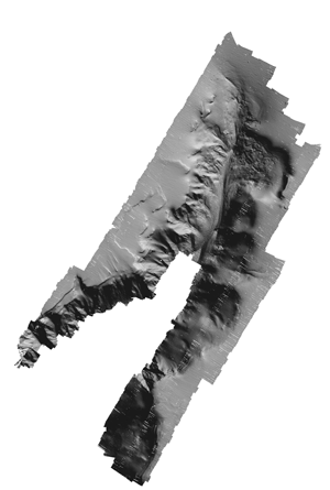
Data presented here include a series of remotely sensed images (multibeam, side scan sonar), derived data (bathymetric contours, grid analyses, etc.), habitat analyses, associated data sets (survey footprints, coastline), and FGDC metadata, grouped by survey location. To download zipped data files from the tables, click on the Data Type name under the desired survey location. Data are presented in ESRI ArcGIS format (shapefiles, grids). Multibeam and sidescan images are Geotiffs. These data are NOT to be used for navigational purposes.
For general data searches, use the SURVEY LOCATION LIST or MAP LOCATOR
Please review our Data Use Policy
Data
Format |
File
Size MB |
Data
Footprint Preview |
|
| CA Geology Series- Continental Margin | 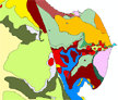 |
||
Shapefile,
polygon |
47 |
||
| ArcGIS(8.3), mxd | 47 |
||
 |
 |
 |
|
GeoTiff |
4 |
||
GeoTiff |
2 |
||
GRID |
3 |
||
Shapefile,
line |
<1 |
||
Shapefile,
point |
26 |
||
GeoTiff |
19 |
||
GRID |
10 |
||
GRID |
<1 |
||
Shapefile,
line |
8 |
||
TXT |
65 |
||
Shapefile,
polygon |
<1 |
||
| Shapefile, layers | <1 |
||
Tiff |
758 |
||
.sd |
15 |
||
GeoTiff |
2 |
||
GeoTiff |
1 |
||
GRID |
2 |
||
GRID |
2 |
||
| Elkhorn Slough - 2011 Data [bathymetric-topographic survey] | |||
GeoTiff |
153 |
||
GRID (asc) |
39 |
||
TXT (xyz) |
159 |
||
TXT (xyz) |
144 |
||
GeoTiff |
15 |
||
GRID |
12 |
||
GRID (asc) |
9 |
||
TXT (xyz) |
10 |
||
GeoTiff |
2 |
||
GeoTiff |
1 |
||
GRID |
4 |
||
.sd, Iview4D viewer |
4 |
||
TXT, point |
3 |
||
 |
|
||
GeoTiff |
265
|
||
GRID |
320 |
||
GRID |
277 |
||
GRID |
392 |
||
Shapefile polygon |
<1 |
||
| GRID | 242 |
||
| GRID | 505 |
||
| GRID | 60 |
||
| GRID, TXT, Fledermaus | 60 |
||
| GRID, TXT, Fledermaus | 55 |
||
Asilomar |
|
|
|
GeoTiff |
3 |
||
GeoTiff |
7 |
||
GRID |
11 |
||
Shapefile polygon |
<1 |
||
| GRID | 5 |
||
| GRID | 2 |
||
TXT |
9 |
||
.sd, Iview3D viewer |
15 |
||
| Shapefile-lines | 2 |
||
Portuguese Ledge |
|
|
|
GeoTiff |
2 |
||
GeoTiff |
<1 |
||
GRID |
5 |
||
Shapefile polygon |
<1 |
||
| GRID | 2 |
||
| GRID | <1 |
||
TXT |
5 |
||
.sd, Iview3D viewer |
6 |
||
| Shapefile-lines | 4 |
||
Soquel East & West |
|
|
|
GeoTiff |
3 |
||
GeoTiff |
1 |
||
GRID |
8 |
||
Shapefile polygon |
<1 |
||
| GRID | 3 |
||
| GRID | <1 |
||
TXT |
8 |
||
.sd, Iview3D viewer |
9 |
||
| Shapefile-lines | 7 |
||
Central Monterey Bay - north |
|
|
|
GeoTiff |
38 |
||
GeoTiff |
92 |
||
GRID |
63 |
||
Shapefile polygon |
<1 |
||
| GRID | 26 |
||
| GRID | 2 |
||
TXT |
61 |
||
.sd, Iview3D viewer |
102 |
||
| Shapefile-lines | 15 |
||
| GRID, TXT, Fledermaus | 5 |
||
Central Monterey Bay - south |
|
|
|
GeoTiff |
75 |
||
GeoTiff |
157 |
||
GRID |
103 |
||
Shapefile polygon |
<1 |
||
| GRID | 45 |
||
| GRID | 2 |
||
TXT |
98 |
||
.sd, Iview3D viewer |
163 |
||
| Shapefile-lines | 19 |
||
| GRID, TXT, Fledermaus | 14 |
||
South Monterey Bay: Hopkins to Del Monte (Geomorphology study 2015) |
|
|
|
Packet |
|||
KMZ |
|||
South Monterey Bay: San Carlos to CSU Monterey Bay (Geomorphology study 2015) |
|
|
|
Packet |
|||
KMZ |
|||
South Monterey Bay: San Carlos to Ft Ord (Geomorphology study 2016) |
|
|
|
Packet |
|||
KMZ |
|||
South Monterey Bay: San Carlos to Ft Ord(2) (Geomorphology study 2016) |
|
|
|
Packet |
|||
KMZ |
|||
Moss Landing nearshore |
|
|
|
GeoTiff |
1 |
||
GRID |
1 |
||
TXT |
1 |
||
.sd, iView4D viewer |
<1 |
||
|
 |
|
|
GeoTiff |
3 |
||
GeoTiff |
2 |
||
GeoTiff |
3 |
||
GeoTiff |
2 |
||
GRID |
4 |
||
Shapefile,
polygon |
<1 |
||
TXT, point |
10 |
||
.sd, Iview3D viewer |
14 |
||
|
 |
|
|
GeoTiff |
2 |
||
GeoTiff |
1 |
||
GRID |
8 |
||
Monterey
Bay Canyon - Spring 2003 [JD84-85]Updated Bathy Grid (8/22/06) |
|
||
GeoTiff |
2 |
||
GeoTiff |
1 |
||
GRID |
2 |
||
Shapefile,
line |
1 |
||
TXT,
point |
7 |
||
| ArcGIS(8.2), mxd | 167 |
||
Monterey Bay Canyon - Fall 2003 [JD256] |
|
||
GeoTiff |
2 |
||
GeoTiff |
1 |
||
GRID |
|||
TXT, point |
18 |
||
Monterey Bay Canyon - Fall 2004 [JD261 & JD324] |
|
||
GeoTiff |
1 |
||
GeoTiff |
1 |
||
GRID |
|||
TXT, point |
18 |
||
GeoTiff |
1 |
||
GeoTiff |
1 |
||
GRID |
|||
TXT, point |
18 |
||
Monterey Bay Canyon - Winter 2005 [JD35-36] |
|
||
GeoTiff |
2 |
||
GeoTiff |
1 |
||
GRID |
2 |
||
TXT, point |
8 |
||
Monterey Bay Canyon - Fall 2005 [JD252] |
|
||
GeoTiff |
2 |
||
GeoTiff |
1 |
||
GRID |
2 |
||
TXT, point |
5 |
||
Monterey Bay Canyon - Winter 2006 [JD54] |
|
||
GeoTiff |
3 |
||
GeoTiff |
1 |
||
GRID |
2 |
||
TXT, point |
8 |
||
Monterey Bay Canyon - Fall 2006 [JD272-273] |
|
||
GeoTiff |
3 |
||
GeoTiff |
1 |
||
GRID |
2 |
||
TXT, point |
|||
Monterey Bay Canyon - Spring 2007 [JD121] |
|
||
GeoTiff |
3 |
||
GeoTiff |
>1 |
||
GRID |
2 |
||
TXT, point |
6 |
||
Monterey Bay Canyon - Fall 2007 [JD257] |
|
||
GeoTiff |
3 |
||
GeoTiff |
>1 |
||
GRID |
2 |
||
TXT, point |
6 |
||
Monterey Bay Canyon - Spring 2008 [JD079-080] |
|
||
GeoTiff |
3 |
||
GeoTiff |
>1 |
||
GRID |
2 |
||
TXT, point |
6 |
||
Monterey Bay Canyon - Fall 2008 [JD243 & JD246] |
|
||
GeoTiff |
3 |
||
GeoTiff |
>1 |
||
GRID |
2 |
||
TXT, point |
6 |
||
Monterey Bay Canyon - Fall 2009 [JD228 & JD229, Nov 24, 25] |
|
||
GeoTiff |
3 |
||
GRID |
3 |
||
.sd, Iview4D viewer |
5 |
||
TXT, point |
5 |
||
Monterey Bay Canyon - Summer 2011 [JD216, Aug 4] |
|
||
GeoTiff |
2 |
||
GRID |
2 |
||
.sd, Iview4D viewer |
4 |
||
TXT, point |
4 |
||
Monterey Bay Canyon - Spring 2013 [JD067 & JD094, Mar 08, 15] |
|
||
GeoTiff |
2 |
||
GRID |
1 |
||
.sd, Iview4D viewer |
3 |
||
TXT, point |
3 |
||
Monterey Bay Canyon - Spring 2014 [JD087, Mar 28] |
|
||
GeoTiff |
1 |
||
GRID |
1 |
||
.sd, Iview4D viewer |
1 |
||
TXT, point |
1 |
||
|
 |
||
| GeoTiff | <1 |
||
| GeoTiff | <1 |
||
TXT,
point |
2 |
||
|
|||
Shapefile,
line |
<1 |
||
| GeoTiff | 4 |
||
Shapefile,
polygon |
11 |
||
GeoTiff |
14 |
||
GeoTiff |
34 |
||
 |
|
 |
|
GeoTiff |
4 |
||
GeoTiff |
9 |
||
GeoTiff |
4 |
||
GeoTiff |
9 |
||
GeoTiff |
133 |
||
GRID |
26 |
||
Shapefile,
line |
<1 |
||
Shapefile,
polygon |
<1 |
||
GRID |
13 |
||
GRID |
5 |
||
GRID |
3 |
||
Shapefile,
point |
<1 |
||
TXT |
20 |
||
.sd, Iview3D viewer |
34 |
||
| TXT | 11 |
||
Monterey
Peninsula- Monastery to Cypress Pt Updated files include original (2000-01) and extended (2004) survey coverage and advanced processing (2006)- |
|
 |
|
GeoTiff |
5 |
||
GeoTiff |
13 |
||
GeoTiff |
5 |
||
GeoTiff |
13 |
||
GeoTiff |
116 |
||
GRID |
42 |
||
Shapefile,
line |
<1 |
||
Shapefile,
polygon |
<1 |
||
GRID |
20 |
||
GRID |
12 |
||
GRID |
3 |
||
Shapefile,
point |
<1 |
||
TXT |
34 |
||
.sd, Iview3D viewer |
54 |
||
| GRID, TXT | 60 |
||
| Monterey Peninsula Offshore 2011- (deep) |
|||
GeoTiff |
<1
|
||
GRID |
1
|
||
Shapefile-pts, lines, polygons |
<1
|
||
| GRID | 1
|
||
| GRID | 1
|
||
TXT |
1
|
||
.sd, Iview3D viewer |
1
|
||
| Shapefile-lines | 5
|
||
Monterey
Peninsula- Pt Pinos to Shalebeds Updated files include original (2000-01) and extended (2004) survey coverage and advanced processing (2006)- |
|
 |
|
GeoTiff |
4 |
||
GeoTiff |
10 |
||
GeoTiff |
4 |
||
GeoTiff |
10 |
||
GeoTiff |
258 |
||
GRID |
31 |
||
Shapefile,
line |
<1 |
||
Shapefile,
polygon |
<1 |
||
GRID |
13 |
||
GRID |
3 |
||
GRID |
1 |
||
Shapefile,
point |
<1 |
||
TXT |
27 |
||
.sd, Iview3D viewer |
43 |
||
| TXT | 3 |
||
| TXT | 20 |
||
| Shalebeds 2012 Re-survey of Shalebeds region |
|||
GeoTiff |
24 |
||
GRID |
20 |
||
| GRID | 7 |
||
TXT |
40 |
||
.sd, Iview3D viewer |
44 |
||
| Shapefile-lines | 5 |
||
|
 |
||
GeoTiff |
3 |
||
GeoTiff |
7 |
||
GeoTiff |
3 |
||
GeoTiff |
8 |
||
GeoTiff |
149 |
||
GRID |
24 |
||
Shapefile,
line |
<1 |
||
Shapefile,
polygon |
<1 |
||
GRID |
11 |
||
GRID |
7 |
||
GRID |
2 |
||
Shapefile,
point |
<1 |
||
TXT |
19 |
||
.sd, Iview3D viewer |
31 |
||
Shapefile,
line |
<1 |
||
| GeoTiff | 4 |
||
| GRID, TXT | 54 |
||
| TXT | 7 |
||
| TXT | 6 |
||
| Whalers Cove, Point Lobos |
|||
GeoTiff |
<1 |
||
GRID |
1 |
||
Shapefile,
line |
<1 |
||
| GRID | 1 |
||
| GRID | <1 |
||
TXT |
1 |
||
.sd, Iview3D viewer |
1 |
||
| Big
Sur- Yankee
Point Updated files include original (2004) survey coverage and advanced processing (2006)- |
 |
||
GeoTiff |
3 |
||
GeoTiff |
8 |
||
GeoTiff |
4 |
||
GeoTiff |
8 |
||
GeoTiff |
232 |
||
GRID |
24 |
||
Shapefile,
line |
<1 |
||
Shapefile,
polygon |
<1 |
||
GRID |
11 |
||
GRID |
4 |
||
GRID |
1 |
||
Shapefile,
point |
<1 |
||
TXT |
22 |
||
.sd, Iview3D viewer |
34 |
||
| GRID, TXT, Fledermaus | 11 |
||
| Big
Sur- Soberanes
Point Updated files include original (2004) survey coverage and advanced processing (2006) |
|
 |
|
GeoTiff |
3 |
||
GeoTiff |
6 |
||
GeoTiff |
3 |
||
GeoTiff |
6 |
||
GeoTiff |
154 |
||
GRID |
19 |
||
Shapefile,
line |
<1 |
||
Shapefile,
polygon |
<1 |
||
GRID |
8 |
||
GRID |
2 |
||
GRID |
1 |
||
Shapefile,
point |
<1 |
||
TXT |
17 |
||
.sd, Iview3D viewer |
28 |
||
| GRID, TXT, Fledermaus | 11 |
||
| Big
Sur- Kasler
Point Updated files include original (2004) survey coverage and advanced processing (2006) |
|
||
GeoTiff |
3 |
||
GeoTiff |
8 |
||
GeoTiff |
3 |
||
GeoTiff |
8 |
||
GeoTiff |
60 |
||
GRID |
25 |
||
Shapefile,
line |
<1 |
||
Shapefile,
polygon |
<1 |
||
GRID |
10 |
||
GRID |
2 |
||
GRID |
1 |
||
Shapefile,
point |
<1 |
||
TXT |
24 |
||
.sd, Iview3D viewer |
37 |
||
| GRID, TXT, Fledermaus | 15 |
||
| Big
Sur- Hurricane
Point Updated files include original (2004) and extended (2005) survey coverage and advanced processing (2006) |
|
||
GeoTiff |
17 |
||
GeoTiff |
36 |
||
GeoTiff |
231 |
||
GRID |
22 |
||
Shapefile,
line |
<1 |
||
Shapefile,
polygon |
<1 |
||
GRID |
10 |
||
GRID |
2 |
||
GRID |
1 |
||
Shapefile,
point |
<1 |
||
TXT |
87 |
||
.sd, Iview3D viewer |
34 |
||
| GRID, TXT, Fledermaus | 13 |
||
| Big Sur- Point Sur Updated files include original (2005) survey coverage and advanced processing (2006) |
|
 |
|
GeoTiff |
8 |
||
GeoTiff |
19 |
||
GeoTiff |
8 |
||
GeoTiff |
19 |
||
GeoTiff |
434 |
||
GRID |
66 |
||
Shapefile,
line |
<1 |
||
Shapefile,
polygon |
<1 |
||
GRID |
26 |
||
GRID |
7 |
||
GRID |
2 |
||
Shapefile,
point |
<1 |
||
TXT |
51 |
||
.sd, Iview3D viewer |
69 |
||
| GRID, TXT, Fledermaus | 9 |
||
| Big Sur- Cooper Pt Updated files include original (2005) survey coverage and advanced processing (2006) |
|
 |
|
GeoTiff |
6 |
||
GeoTiff |
12 |
||
GeoTiff |
399 |
||
GRID |
54 |
||
Shapefile,
line |
<1 |
||
Shapefile,
polygon |
<1 |
||
GRID |
17 |
||
GRID |
3 |
||
GRID |
2 |
||
Shapefile,
point |
<1 |
||
TXT |
131 |
||
.sd, Iview3D viewer |
188 |
||
| GRID, TXT, Fledermaus | 22 |
||
| Big Sur- Grimes Pt Updated files include original (2005) survey coverage and advanced processing (2006) |
|
 |
|
GeoTiff |
5 |
||
GeoTiff |
12 |
||
GeoTiff |
5 |
||
GeoTiff |
12 |
||
GeoTiff |
294 |
||
GRID |
40 |
||
Shapefile,
line |
<1 |
||
Shapefile,
polygon |
<1 |
||
GRID |
18 |
||
GRID |
5 |
||
GRID |
2 |
||
Shapefile,
point |
<1 |
||
TXT |
87 |
||
.sd, Iview3D viewer |
50 |
||
| GRID, TXT, Fledermaus | 34 |
||
| Big Sur- Slate Rock new (2006) |
|
 |
|
GeoTiff |
5 |
||
GeoTiff |
11 |
||
GeoTiff |
5 |
||
GeoTiff |
11 |
||
GeoTiff |
327 |
||
GRID |
45 |
||
Shapefile,
line |
<1 |
||
Shapefile,
polygon |
<1 |
||
GRID |
20 |
||
GRID |
6 |
||
GRID |
2 |
||
Shapefile,
point |
1 |
||
TXT |
39 |
||
.sd, Iview3D viewer |
56 |
||
| GRID, TXT, Fledermaus | 40 |
||
|
|||
GeoTiff |
13
|
||
GeoTiff |
9
|
||
GRID |
25
|
||
Shapefile-pts, lines, polygons |
<1
|
||
| GRID | 6
|
||
| GRID | 3
|
||
TXT |
20
|
||
.sd, Iview3D viewer |
31
|
||
| Shapefile-lines | 4
|
||
| GRID, TXT, Fledermaus | 44 |
||
Big Creek South 2010 |
|
||
GeoTiff |
14
|
||
GeoTiff |
9
|
||
GRID |
27
|
||
Shapefile-pts, lines, polygons |
<1
|
||
| GRID | 7
|
||
| GRID | 3
|
||
TXT |
21
|
||
.sd, Iview3D viewer |
34
|
||
| Shapefile-lines | 5
|
||
| GRID, TXT, Fledermaus | 51 |
||
Lopez Point 2010 |
|
||
GeoTiff |
14
|
||
GeoTiff |
9
|
||
GRID |
27
|
||
Shapefile-pts, lines, polygons |
<1
|
||
| GRID | 7
|
||
| GRID | 3
|
||
TXT |
21
|
||
.sd, Iview3D viewer |
34
|
||
| Shapefile-lines | 5
|
||
| GRID, TXT, Fledermaus | 50 |
||
| Big Sur- Big Creek Ecological Reserve |
|
||
GeoTiff |
1 |
||
GeoTiff |
36 |
||
GeoTiff |
15 |
||
GeoTiff |
16 |
||
Shapefile, line |
<1 |
||
Shapefile, line |
<1 |
||
Shapefile, line |
<1 |
||
Shapefile, polygon |
<1 |
||
Shapefile, polygon |
<1 |
||
Shapefile, polygon |
<1 |
||
Shapefile, line |
<1 |
||