

DATA LIBRARY
NORTHERN CALIFORNIA DATA
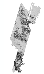
Data presented here include a series of remotely sensed images (multibeam, side scan sonar), derived data (bathymetric contours, grid analyses, etc.), habitat analyses, associated data sets (survey footprints, coastline), and FGDC metadata, grouped by survey location. To download zipped data files from the tables, click on the Data Type name under the desired survey location. Data are presented in ESRI ArcGIS format (shapefiles, grids). Multibeam and sidescan images are Geotiffs. These data are NOT to be used for navigational purposes.
For general data searches, use the SURVEY LOCATION LIST or MAP LOCATOR
Please review our Data Use Policy
Data
Format |
File
Size MB (zipped) |
Data
Footprint Preview |
|
| CA Geology Series- Continental Margin |  |
||
Shapefile,
polygon |
47 |
||
| ArcGIS(8.3), mxd | 47 |
||
 |
 |
||
GeoTiff |
59 |
||
Shapefile,
polygon |
1 |
||
|
 |
||
GeoTiff |
4 |
||
GeoTiff |
7 |
||
| GeoTiff | |||
GRID |
6 |
||
GRID |
2 |
||
GRID |
11 |
||
Shapefile, line |
<1 |
||
Shapefile, polygon |
<1 |
||
Shapefile, point |
<1 |
||
Shapefile, point |
1 |
||
TXT |
17 |
||
.sd, Iview3D viewer |
16 |
||
| GeoTiff | 4 |
||
Humboldt Bay, South |
|
||
GeoTiff |
2 |
||
GeoTiff |
4 |
||
| GeoTiff | |||
GRID |
3 |
||
GRID |
1 |
||
GRID |
5 |
||
Shapefile, line |
1 |
||
Shapefile, polygon |
<1 |
||
Shapefile, point |
<1 |
||
Shapefile, point |
1 |
||
TXT |
6 |
||
.sd, Iview3D viewer |
16 |
||
| GeoTiff | 4 |
||
Humboldt Bay, Data Fusion Project |
|||
various |
130 |
||
 |
|||
GeoTiff |
5 |
||
GeoTiff |
2 |
||
| GeoTiff | 20 |
||
| GeoTiff | 20 |
||
GRID |
19 |
||
GRID |
8 |
||
GRID |
33 |
||
Shapefile,
line |
33 |
||
Shapefile,
line |
13 |
||
Shapefile,
polygon |
<1 |
||
Shapefile,
polygon |
8 |
||
Shapefile, line |
1 |
||
| Note: These data are merged with the 2001 survey. | |
 |
|
GeoTiff |
8 |
||
| GeoTiff | 4 |
||
| GeoTiff | 28 |
||
GRID |
21 |
||
GRID |
5 |
||
GRID |
16 |
||
GRID |
<1 |
||
GRID |
<1 |
||
GRID |
<1 |
||
Shapefile, line |
<1 |
||
Shapefile, line |
5 |
||
Shapefile, polygon |
<1 |
||
Shapefile, point |
<1 |
||
Shapefile, point |
<1 |
||
Shapefile, point |
<1 |
||
Shapefile, line |
<1 |
||
|
|||
GeoTiff |
2 |
||
GeoTiff |
3 |
||
GeoTiff |
144 |
||
GRID |
14 |
||
GRID |
7 |
||
GRID |
22 |
||
Shapefile,
line |
13 |
||
Shapefile,
polygon |
1 |
||
Shapefile,
polygon |
2 |
||
TXT |
29 |
||
Shapefile,
line |
1 |
||
 |
 |
||
GeoTiff |
6 |
||
GeoTiff |
15 |
||
GeoTiff |
27 |
||
GRID |
16 |
||
GRID |
7 |
||
GRID |
27 |
||
Shapefile,
line |
2 |
||
Shapefile,
polygon |
<1 |
||
Shapefile,
point |
<1 |
||
Shapefile,
point |
<1 |
||
Shapefile,
point |
<1 |
||
Shapefile, line |
1 |
||
|
 |
||
GeoTiff(s) |
79 |
||
Shapefile, polygon |
12 |
||
 |
|
||
GeoTiff |
15 |
||
GeoTiff |
22 |
||
GeoTiff |
11 |
||
GeoTiff |
67 |
||
GeoTiff |
21 |
||
GeoTiff |
44 |
||
GRID |
20 |
||
GRID |
9 |
||
GRID |
35 |
||
GRID |
24 |
||
GRID |
13 |
||
GRID |
51 |
||
Shapefile,
line |
9 |
||
Shapefile,
line |
14 |
||
Shapefile,
polygon |
1 |
||
Shapefile,
polygon |
1 |
||
Shapefile,
polygon |
5 |
||
Shapefile,
polygon |
5 |
||
Shapefile,
polygon |
<1 |
||
Shapefile,
polygon |
2 |
||
Shapefile,
point |
<1 |
||
Shapefile,
point |
<1 |
||
Shapefile,
point |
<1 |
||
Shapefile,
line |
<1 |
||