Data Acquisition & Processing
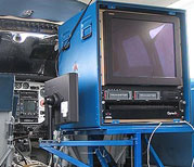
Multibeam Echo Sounder (MBES) surveysReson SeaBat 8101 (210 kHz), 8111 (100kHz), 7125 (400 kHz) and 7111 (100 kHz) multibeam echo sounders are used for sonar data acquisition (calibrated via NOAA standard patch test). The high-resolution (dense) data acquired by these multibeam systems provides 100% coverage of the seafloor within the surveyed areas. Multibeam bathymetry provides the basic raw data being used by CSMP to define topographical features such as sediment interfaces, rock outcrops, and important seafloor habitat.
Airborne LIDAR Bathymetry (ALB)Airborne LIDAR Bathymetry (ALB) is used to survey areas too shallow for safe or efficient coverage by conventional vessel-based acoustic survey methods. The SHOALS-1000T Airborne LIDAR Sensor (1kHz bathymetric green laser) produces imagery that can be assessed similiar to sidescan sonar or multibeam backscatter. Prior to LIDAR acquisition, ground control stations are established and referenced. During LIDAR operations, dual frequency GPS receivers are set-up on the established ground control points and are operational for all data acquisition flights, allowing for post processed inertially aided kinematic positioning of all data.
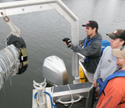
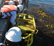
Ground-Truthing DataGround truthing is conducted via video and still camera imagery and/or physical sediment samples to inform and validate the interpretation of the acoustic and LIDAR data products.
 Map generation products follow a 3-tiered approach-- from basic survey data to highly detailed habitat classification.
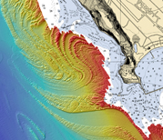 Maverick's - Half Moon Bay, CA