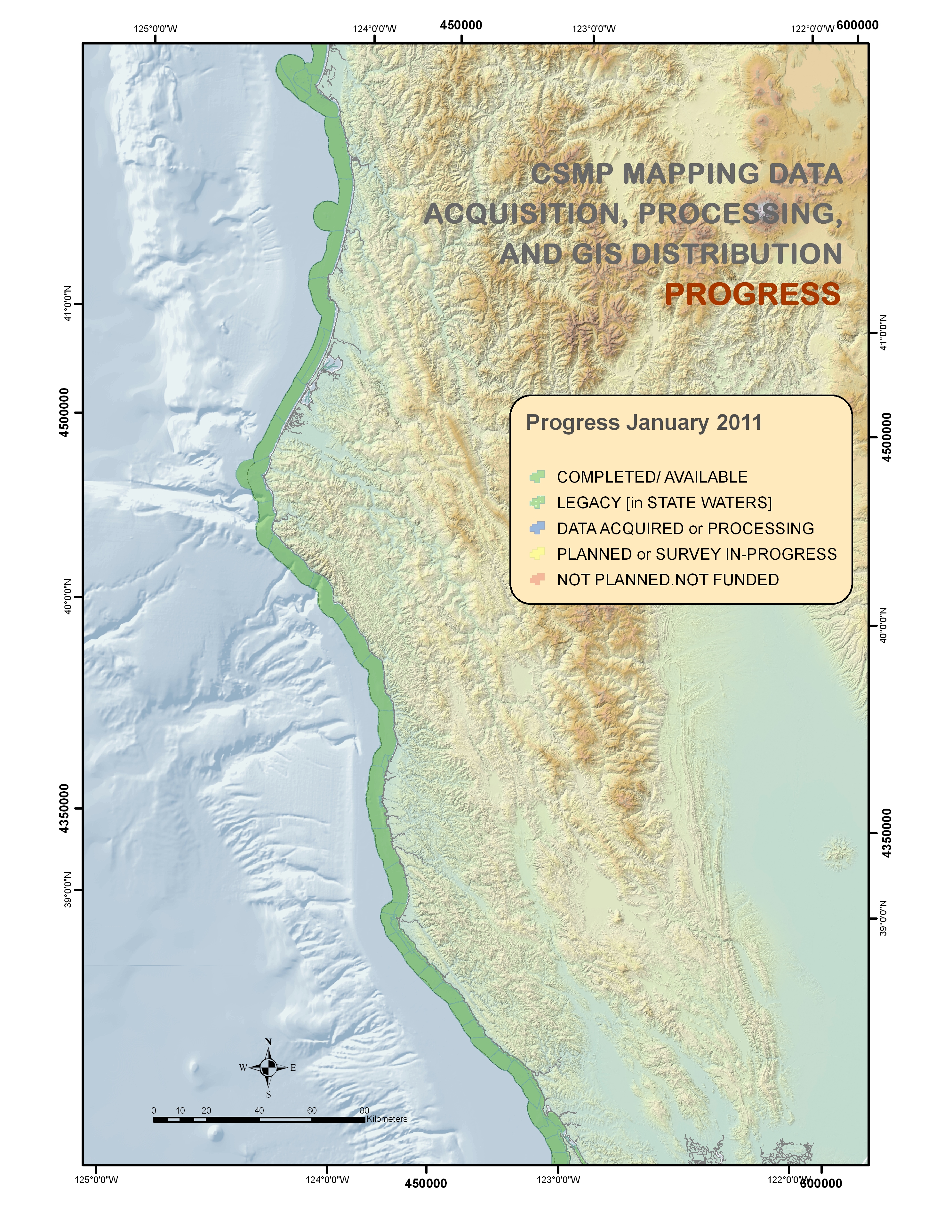
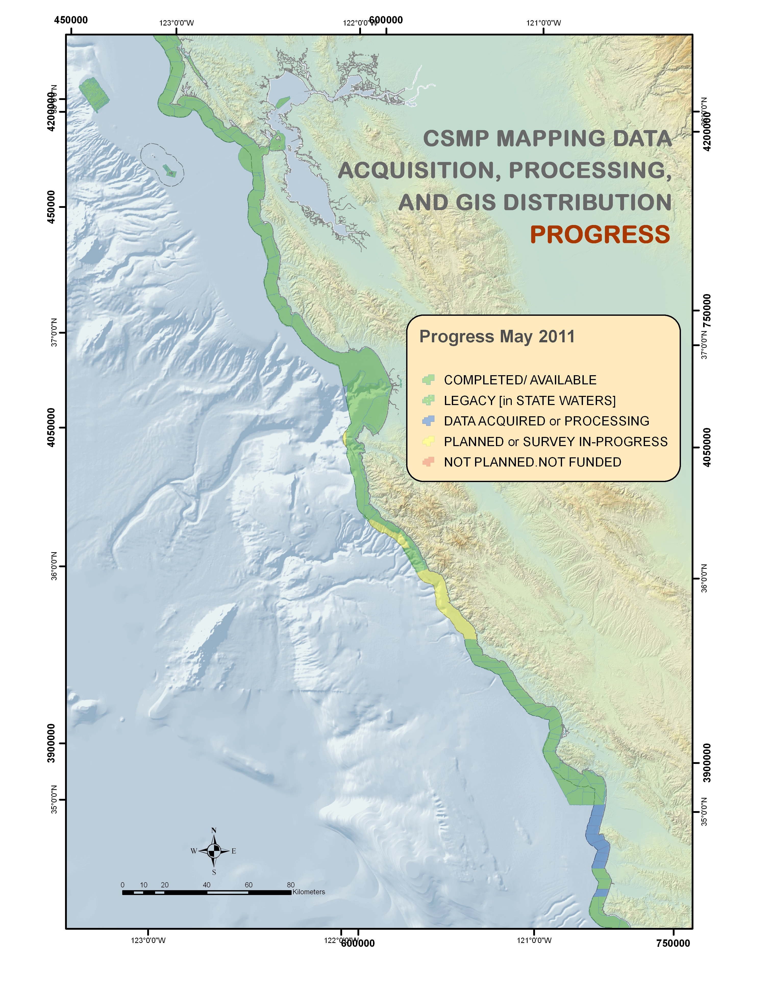
CSMP Progress Maps
Status of mapping data acquisition, processing, and GIS product distribution
These maps provide a visual overview of CSMP data collection, post-processing and habitat classification, and data availability via the SFML Data Library or other web portal (i.e Legacy data). More information can be found by contacting the SFML Data Manager at cbretz@csumb.edu.
Map Legend
![]() Data Competed / Available
Data Competed / Available
![]() Legacy Data / Previously Collected & Available
Legacy Data / Previously Collected & Available
![]() Data Acquired or Currently being Processed
Data Acquired or Currently being Processed
![]() Planned Collection or Survey In-Progress
Planned Collection or Survey In-Progress
![]() Not Planned / Not Funded
Not Planned / Not Funded
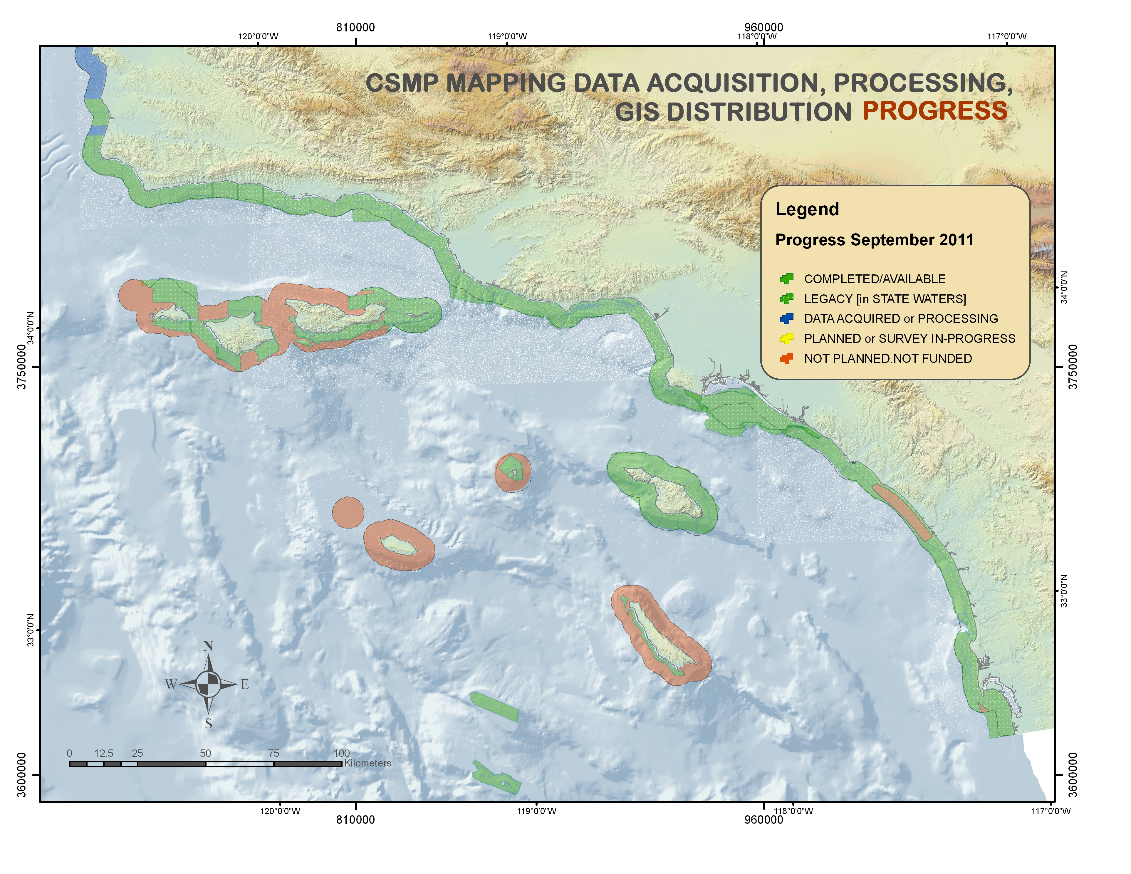
Last updated September 19, 2011
*San Nicolas Island (2012), San Clemente Island (2013), and data gaps between Dana Point and Imperial Beach (2014, Southern California Data Gaps project) have been mapped and processed by SFML.
 Map generation products follow a 3-tiered approach-- from basic survey data to highly detailed habitat classification.
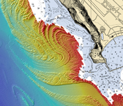 Maverick's - Half Moon Bay, CA